


Clear Creek FHAD Study from South Platte River to Clear Creek Canyon
Prepared by ICON Engineering for MHFD
BACKGROUND
The intent of this Flood Hazard Area Delineation (FHAD) effort is to update the hydrologic information of two previous FHAD studies. The first study was completed in December 2005 by Ayres Associates and is titled “Flood Hazard Area Delineation – Clear Creek (Adams County).” The second study is dated April 2007 by ICON Engineering, Inc. and is titled “Flood Hazard Area Delineation – Clear Creek – Jefferson County & City and County of Denver.” This study supersedes the previous studies and provides an up-to-date analysis of the existing floodplain along Clear Creek so that project stakeholders, and other users, can implement floodplain zoning ordinances, floodplain regulations, and other land-use controls, as needed, to reduce potential damages and adverse development in the floodplain.
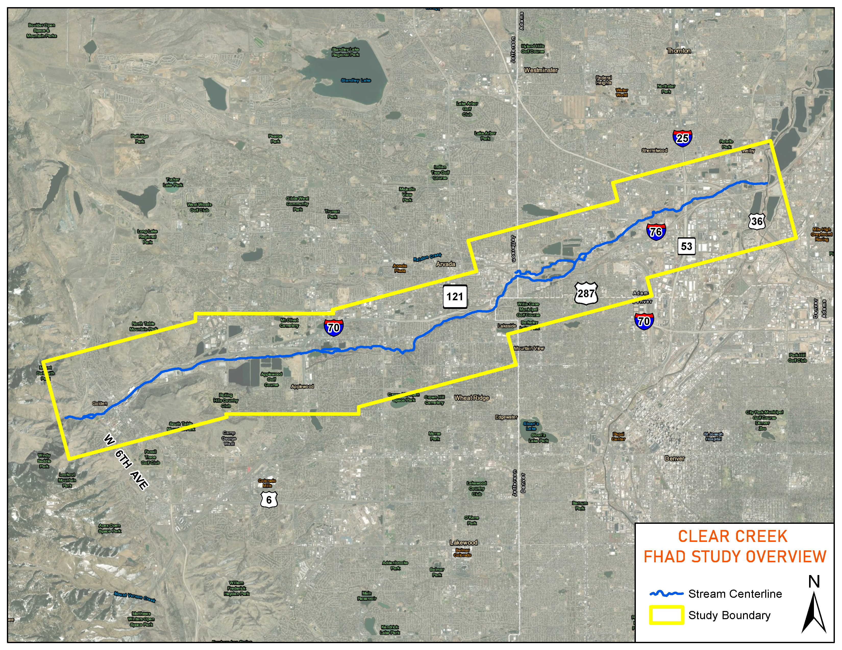
PROJECT AREA MAP
FHAD VIEWER
PUBLIC MEETING ANNOUNCEMENT
Clear Creek Flood Hazard Area Delineation Virtual Public Information Meeting
Wednesday, December 9, 2020
6:00 p.m. to 7:00 p.m.
Adams County / City and County of Denver / Jefferson County / City of Arvada / City of Wheat Ridge / City of Golden
New community flood hazard maps are being prepared for Clear Creek from 6th Avenue in Golden to its confluence with the South Platte River in Adams County. The purpose of this meeting is to share the new flood maps and other information to help residents and business owners make informed decisions about protecting their property.
RSVP for public meeting:
epaulsen@mhfd.org
OR
(303)749-5410
CONTACT
Questions and Comments
PROJECT MEMBERS
Project Members
- ICON Engineering, Inc.
- 7000 S Yosemite St, Ste 120
- Centennial, CO 80112
- www.iconeng.com
- (303)221-0802
- Troy Carmann
- tcarmann@iconeng.com
- Justen Hamann
- jhamann@iconeng.com
- Brooke Seymour
- bseymour@udfcd.org
- Dan Hill
- dhill@udfcd.org
- Greg Labrie
- glabrie@adcogov.org
- Lauren Copenhagen
- lcopenha@co.jefferson.co.us
- Pat O'Connell
- poconnel@co.jefferson.co.us
- Andrew Stewart
- astewart@arvada.org
- Jeremy Hamer
- jeremy.hamer@denvergov.org
- Joe Puhr
- jpuhr@cityofgolden.net
- Mark Westberg
- mwestberg@ci.wheatridge.co.us